Quaternary Geology of Michigan
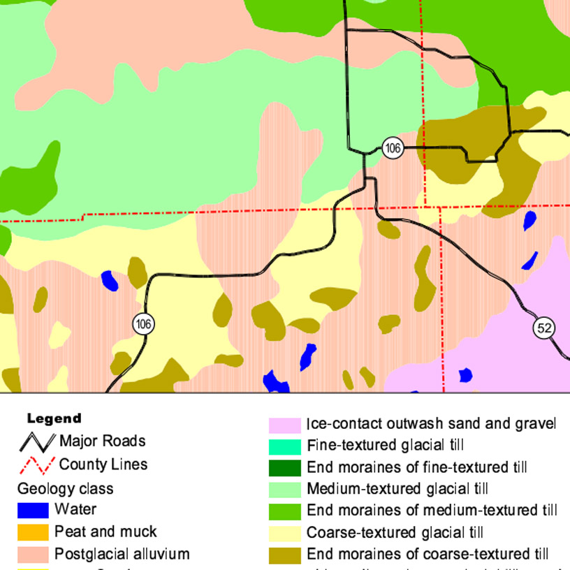
The Michigan government provides basic quaternary geology maps of each county.
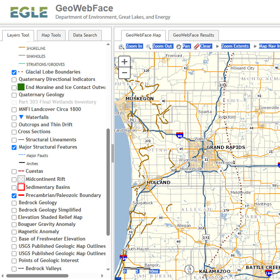
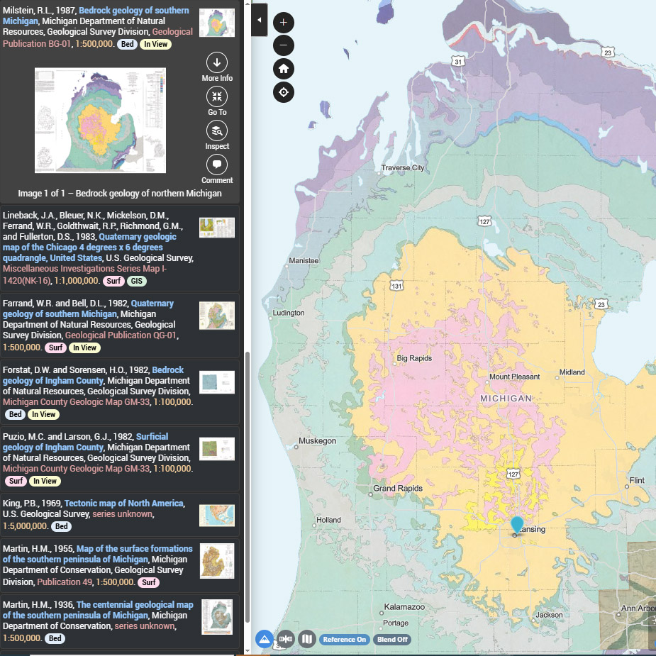
GeoWebFace - Made by the State of Michigan, GeoWebFace contains geologic and geographic information unique to Michigan. It offers an interactive map showing glacial, quaternary, structural features, bedrock, Bouguer Gravity and other layers. It also displays the Public Land Survey System down to the Quarter-Quarter Section in relation to political and cultural features, and mineral rights and lease information.

 Michigan Geography and Geology
by
Michigan Geography and Geology
by
 Geology of Michigan
by
Geology of Michigan
by
The National Geologic Map Database has a large collection of scanned government reports published at the state and national level about the entire United States including Michigan. Use the Interactive map to zoom in to your place of interest, and retrieve a list of scanned geologic reports on that place.
Well Logs have been officially collected since the 1960s and have been scanned and uploaded to online systems over time. The easiest way to find them is to search them using the EGLE Water Well Viewer. If you are looking for a known well and aren't finding it there, try Wellogic or the Scanned paper records below. The EGLE Water Well Viewer and GeoWebFace can help you determine the Public Land Survey System designation which you need for a property of interest.

For wells drilled 2000 to the present (and numerous older wells):
Go to the Wellogic. In the search area choose your county from the pulldown list, then your township, then your section. When you click 'go' a new window will pop up with a list of all the recently drilled wells in that section, and some pre-2000 wells.
 EXAMPLE
For wells drilled 1965 to 1999:
Scanned Water Well Retrieval System
Each PDF file contains records for wells within a single section (square mile). They don't appear to be in much order within the PDF. The land owner's address on the right side of the page will not necessarily be where the well was drilled. This means you have to pay close attention to the description of the location of the well, which is sometimes provided on the left side of the page, and often in the legal description at the top of the page.
 Example
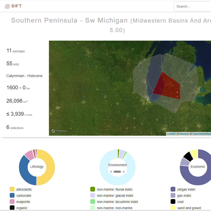
MacroStrat provides